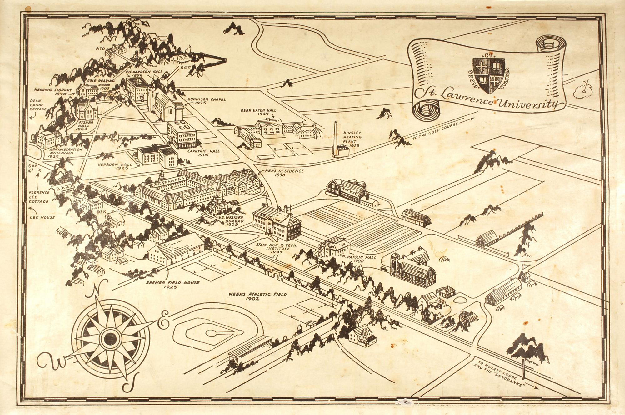
Explore this collection building Overview Creator: unknown Subject: St. Lawrence University -- HistorySt. Lawrence University -- Maps Description:This "place mat"-sized map shows a panorama of all campus buildings in the mid-1930s time frame, including the buildings and barns belonging to the New York State Agricultural and Technical Institute. Coverage:Canton, NY Source:Map, ink on paper, 13" h x 19" w Date Original:[193?] Decade:Tue, 12/31/1929 - 20:00 Rights Rights Management:Original materials may be protected by the Copyright Law of the United States (more information). Resource Identifier:ODY Special Collections, Mss 70, St. Lawrence University Maps Publisher:St. Lawrence University Contributor:St. Lawrence University Technical Digitization Specifications:Scanned at 600ppi on Epson 1000XL scanner as 48-bit RGB uncompressed TIFF images. Images resized to 2000 pixels wide, 150 dpi, and saved as JPEG (level 10) in Photoshop CS5 with Unsharp Mask of 60:1. Date Digital:Thu, 01/19/2012 - 20:00 Format:image/jpeg Type:Still Image Contributing Institution:St. Lawrence University