Skip to main content
Home
Library
Art Gallery
Teaching
Search Query:
Search
Home
Aerials
Panoramas
Buildings
Maps
Home
SLU Photographs Collection
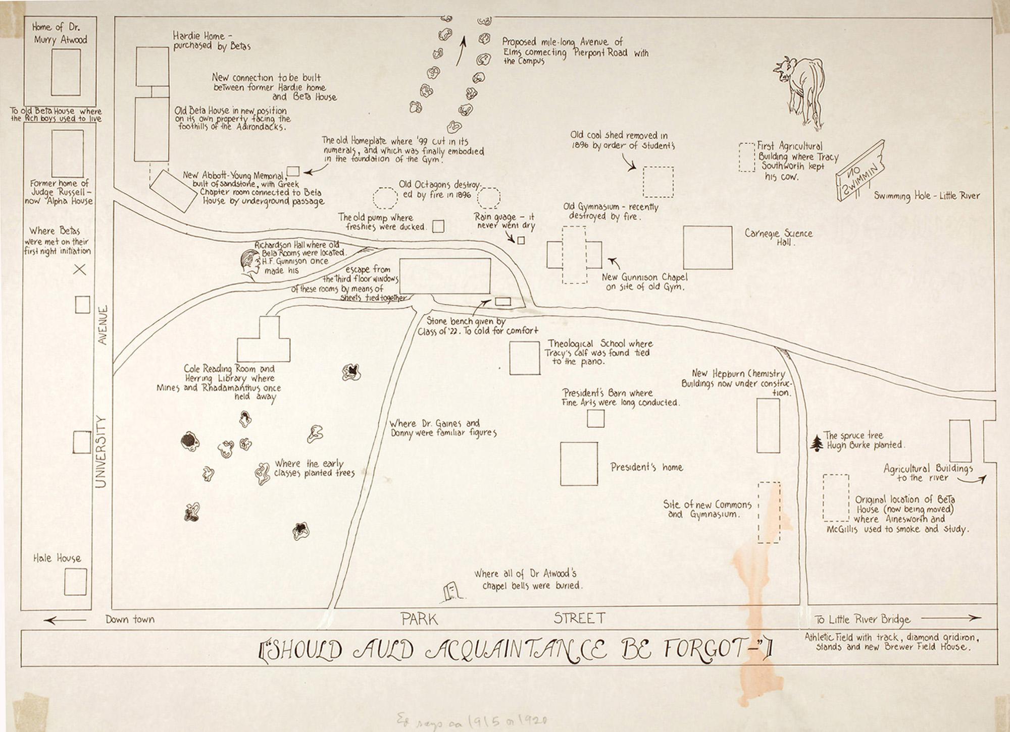
SLU Picture Map--1920s
Explore this collection
building
Overview
Creator:
unknown
Subject:
St. Lawrence University -- History
St. Lawrence University -- Maps
Description
:
This "map" was drawn sometime during the mid 1920s and contains references to students, faculty members, activities and landmarks which were significant to SLU in the early part of the 20th century.
Coverage
:
Canton, NY
Source
:
map, hand-drawn, 13 7/8" h x 19" w
Date Original
:
[192?]
Decade
:
Wed, 12/31/1919 - 20:00
Rights
Rights Management
:
Original materials may be protected by the Copyright Law of the United States
(more information)
.
Resource Identifier
:
ODY Special Collections, Mss 70, St. Lawrence University Maps
Publisher
:
St. Lawrence University
Contributor
:
unknown
Technical
Digitization Specifications
:
Scanned at 600ppi on Epson 1000XL scanner as 48-bit RGB uncompressed TIFF images. Images resized to 960 pixels wide, 150 dpi, and saved as JPEG (level 10) in Photoshop CS5 with Unsharp Mask of 60:1.
Date Digital
:
Thu, 01/19/2012 - 20:00
Format
:
image/jpeg
Type
:
Still Image
Contributing Institution
:
St. Lawrence University